yough river
overview
(39.86973 N Lat/ -79.49113 W Long) Ohiopyle Borough. (39.82628 N Lat/ -79.37882 W Long) Ramcat put-in parking.
Two sets of coordinates are provided. Those for Ohiopyle Borough indicate the parking area used by cyclists on the Great Allegheny Passage bike/hike trail, which flanks the river throughout Ohiopyle State Park. Anglers may use this lot to park when accessing the river either upstream or downstream of Ohiopyle Borough. Anglers who are hiking or biking on the trail, should not drive farther upriver from this point, as parking there is reserved for “take-out” parking for boaters floating the Middle Youghiogheny down from Confluence. Signage indicates “Boater Parking Only.” Of course, this privilege includes those anglers fishing from a kayak, canoe, or raft.
The Ramcat coordinates indicate the Ramcat boat-launch parking lot upriver at Confluence. Cyclists on the Great Allegheny Passage Trail also use this lot, as do anglers accessing the river, primarily downstream.
Both parking lots are public, provided by Ohiopyle State Park.

A Tailwater Fishery
The Youghiogheny River is a rapidly developing tailwater fishery, enhanced by coldwater “bottom discharge” from the Youghiogheny Reservoir upstream at Confluence, PA. The Pennsylvania Fish and Boat Commission manages the river as a coldwater fishery for approximately 35 miles, from Confluence downriver to Connellsville. Nearly this entire span of river flows through Ohiopyle State Park, open to public fishing. The Fish and Boat Commission stocks hundreds of thousands of fingerling trout in the Youghiogheny every year, and the PFBC Cooperative Nursery operated by Chestnut Ridge Chapter, Trout Unlimited in the Youghiogheny Reservoir tailrace supplies adult and trophy-size trout to the river fishery, as well as to numerous youth fishing events in the region.
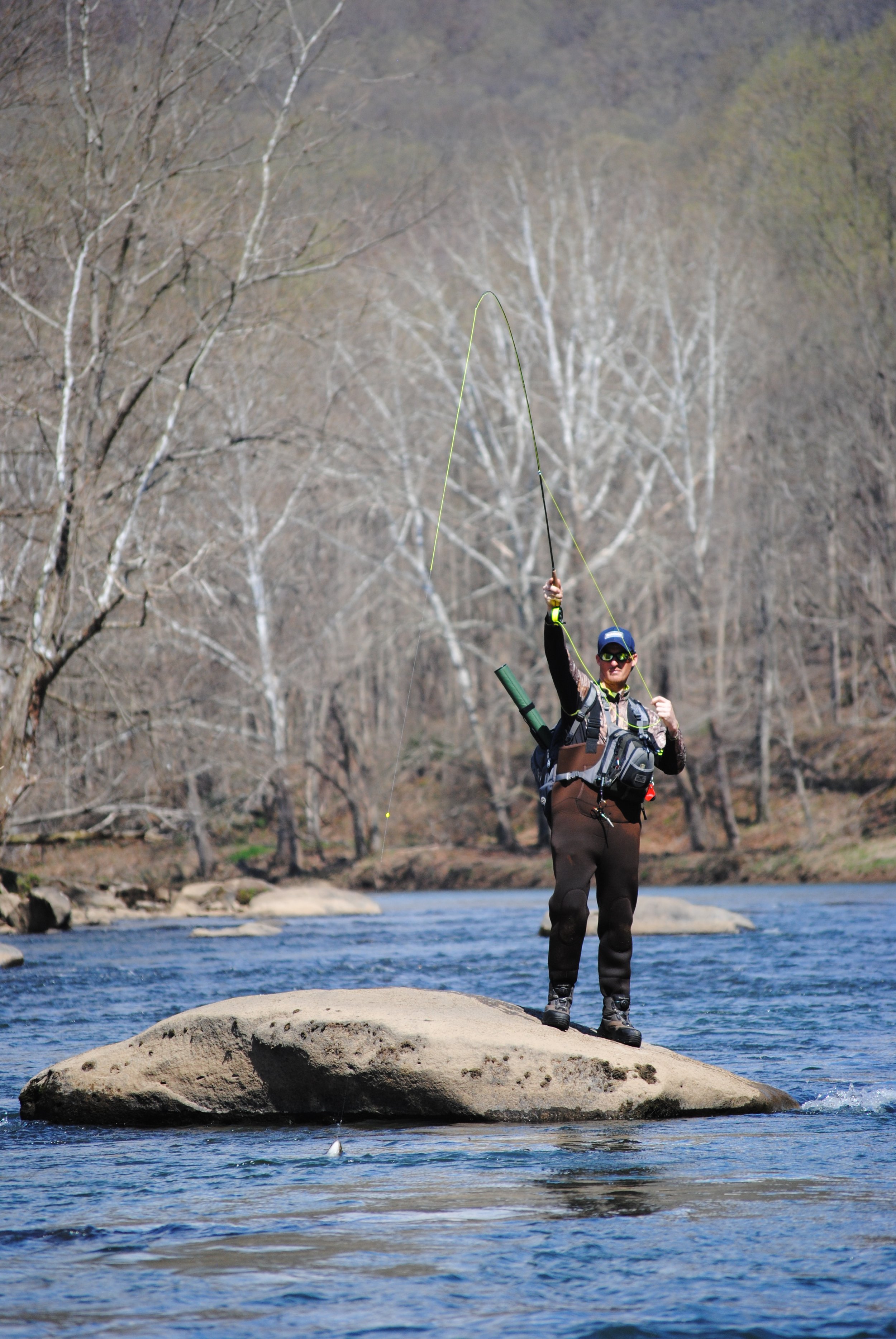
Serious considerations should be made before embarking on any fishing excursion on “The Yough.” The Youghiogheny is a big, fast-flowing river, the bottom of which is mostly large, angular, and randomly shaped boulders and large rock, notorious for their slippery surfaces. Some slower pools are available, but most of the river features fast gradient and rapids. Wading can be treacherous.
Middle Yough
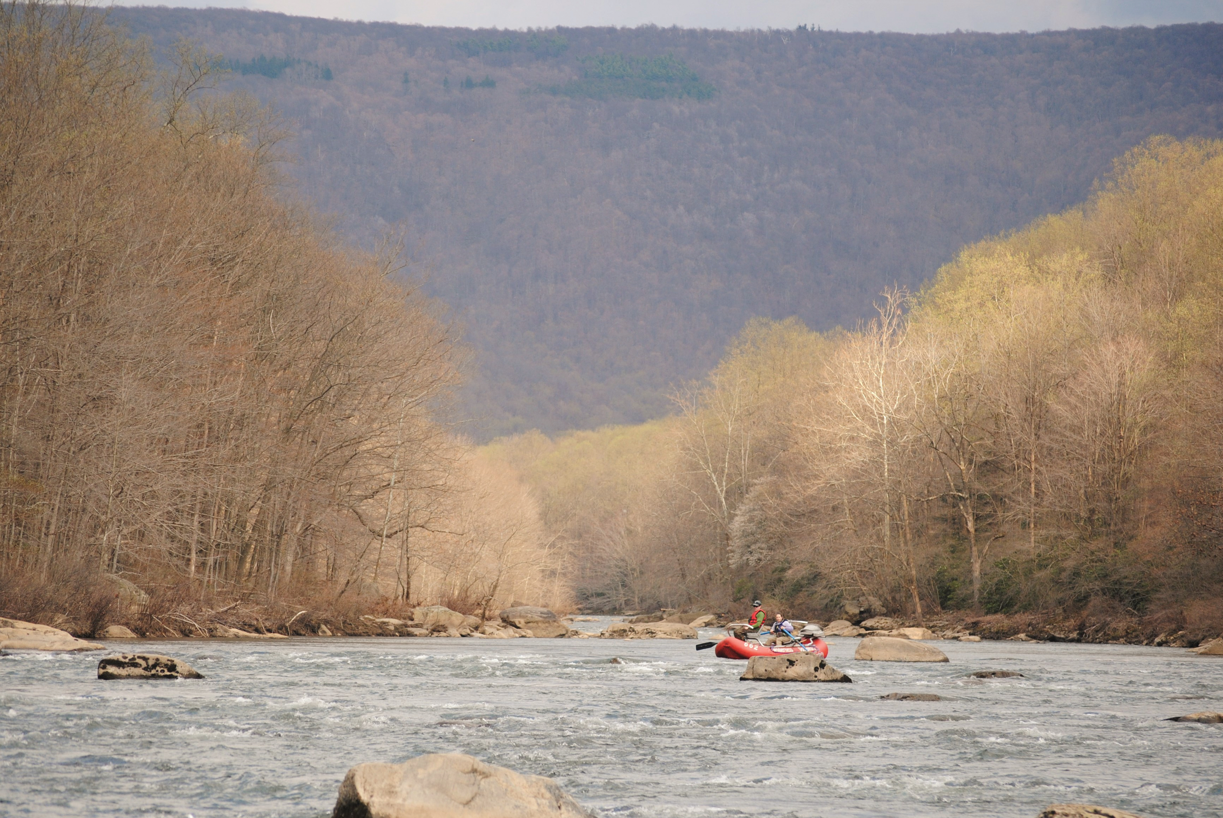
The river from Confluence down to Connellsville is generally considered as two separate stretches, because of marked differences in gradient and flow. The 10-mile span from Confluence down to Ohiopyle is known as the “Middle Yough,” which features lower gradient, some slack pools, and better access. Rapids on the Middle Yough are generally considered Class I and Class II, though higher flows result in Class III rapids in some places. Being nearer to the dam, this section has colder temperatures through the summer months. Angler access is easier because the slopes above the river are gentler than along the Lower Yough, and several sets of stairways, built by Chestnut Ridge Chapter, Trout Unlimited, facilitate the descent from the trail to the river. Many anglers fish this stretch by launching a kayak, raft, or canoe at the Ramcat put-in, then taking out at Ohiopyle.
Anglers fishing from boats or rafts on the Middle Yough must not miss the “Take Out” sign on “river left” (left-hand bank when headed downstream), visible soon after passing through the rapids at Elephant Rock. This well-known feature is a huge boulder in the middle of the river that resembles an elephant, with its head and trunk pointing toward “river right.” The safest route here is to your right of the elephant. Once safely through, immediately head toward the left bank and look for the “Take Out” sign, and the modest “beach” for landing. If you pass that point, the current quickens toward Ohiopyle Falls, just around the bend beyond the Route 381 bridge, and it may be difficult to reach shore before going over the falls.
Lower Yough
The 20+ mile section from Ohiopyle downstream to Connellsville is known as the “Lower Yough,” the section most frequently used by whitewater rafting outfitters operating out of Ohiopyle. This section features Class III to V rapids. Access is difficult because of steep, rocky slopes to the river, and there are no stairways along this span. The “Loop” section of the Lower Yough, immediately downstream from Ohiopyle Borough, can be reached on foot via the trails on Ferncliff Peninsula. Still, however, final approaches to the water require negotiating steep slopes and rocky terrain. Those who do find a way to fish the Lower Yough, will find what’s essentially a wilderness experience relatively low angling pressure because of its difficulty to reach.
Most anglers access the Youghiogheny by short wading trips from Ohiopyle or Confluence. Other, more mobile anglers use bicycles to travel the Great Allegheny Passage trail many miles upriver or down. Some use their own drift boats or fishing-outfitted rafts to float-fish the Middle Yough. A few also float-fish the Lower Yough, but technical skill at navigating serious whitewater is a must there. Several guide services operate out of Ohiopyle and Confluence, offering guided float trips, primarily on the Middle Yough.
Special Regulations
The Middle Yough, from the confluence with Ramcat Run, downriver 9.2 miles to the Rte. 381 bridge in Ohiopyle is managed under special regulation as All Tackle Trophy Trout water. The daily creel limit here is one trout per day, minimum size 18 inches, from the opening day of trout season through Labor Day. No trout may be killed or possessed from Labor Day, until the following first Saturday in April (generally, the opening day of trout season). There are no tackle restrictions.
Finding the right fly or lure on the Youghiogheny can be difficult on any given day, but trout do respond to every tactic from large streamers to tiny dry fly midge patterns. Large terrestrial dry flies such as hoppers or Chernobyls can be effective throughout the summer.
The Youghiogheny River provides “destination” trout fishing experiences, with large trout in a strikingly wild and remote setting. Physical effort here can pay off with memorable fishing.